
Publications
Annual Demographic Estimates: Subprovincial Areas
2014
- Main page
- Section 1: Census metropolitan areas
- Section 2: Economic regions and regional portraits
- Section 3: Census divisions
- Section 4: Maps
- Quality of demographic data
- Methodology
- Appendix A: Glossary
- Appendix B: Explanatory notes for the tables
- Appendix C: Sources and remarks
- More information
- Related products
- PDF version
Section 4: Maps

Archived Content
Information identified as archived is provided for reference, research or recordkeeping purposes. It is not subject to the Government of Canada Web Standards and has not been altered or updated since it was archived. Please "contact us" to request a format other than those available.
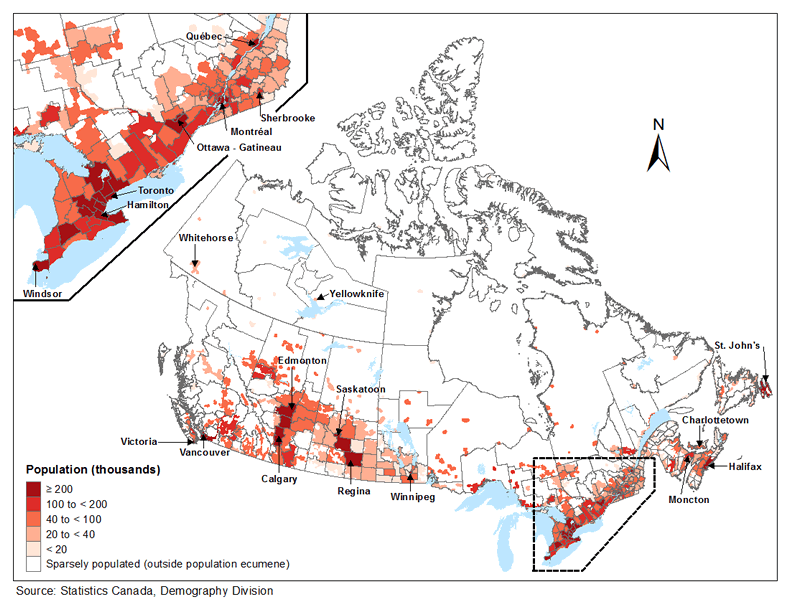
- Map 4.1 Population distribution as of July 1, 2014 by census division (CD), Canada
- Map 4.2 Population growth rates between July 1, 2013 and June 30, 2014 by census division (CD), Canada
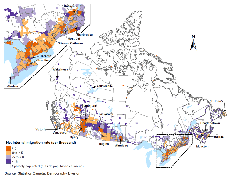
- Map 4.3 Net internal migration rates between July 1, 2013 and June 30, 2014 by census division (CD), Canada
- Map 4.4 Median age as of July 1, 2014 by census division (CD), Canada
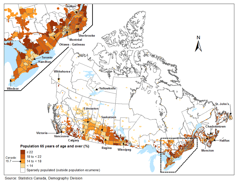
- Map 4.5 Proportion of population 65 years of age and over as of July 1, 2014, by census division (CD), Canada
Map 4.1 Population distribution as of July 1, 2014 by census division (CD), Canada
Map 4.2 Population growth rates between July 1, 2013 and June 30, 2014 by census division (CD), Canada

Map 4.3 Net internal migration rates between July 1, 2013 and June 30, 2014 by census division (CD), Canada
Map 4.4 Median age as of July 1, 2014 by census division (CD), Canada

Map 4.5 Proportion of population 65 years of age and over as of July 1, 2014, by census division (CD), Canada
- Date modified: