
Health Regions: Boundaries and Correspondence with Census Geography
Map 12
British Columbia Health Regions, 2018
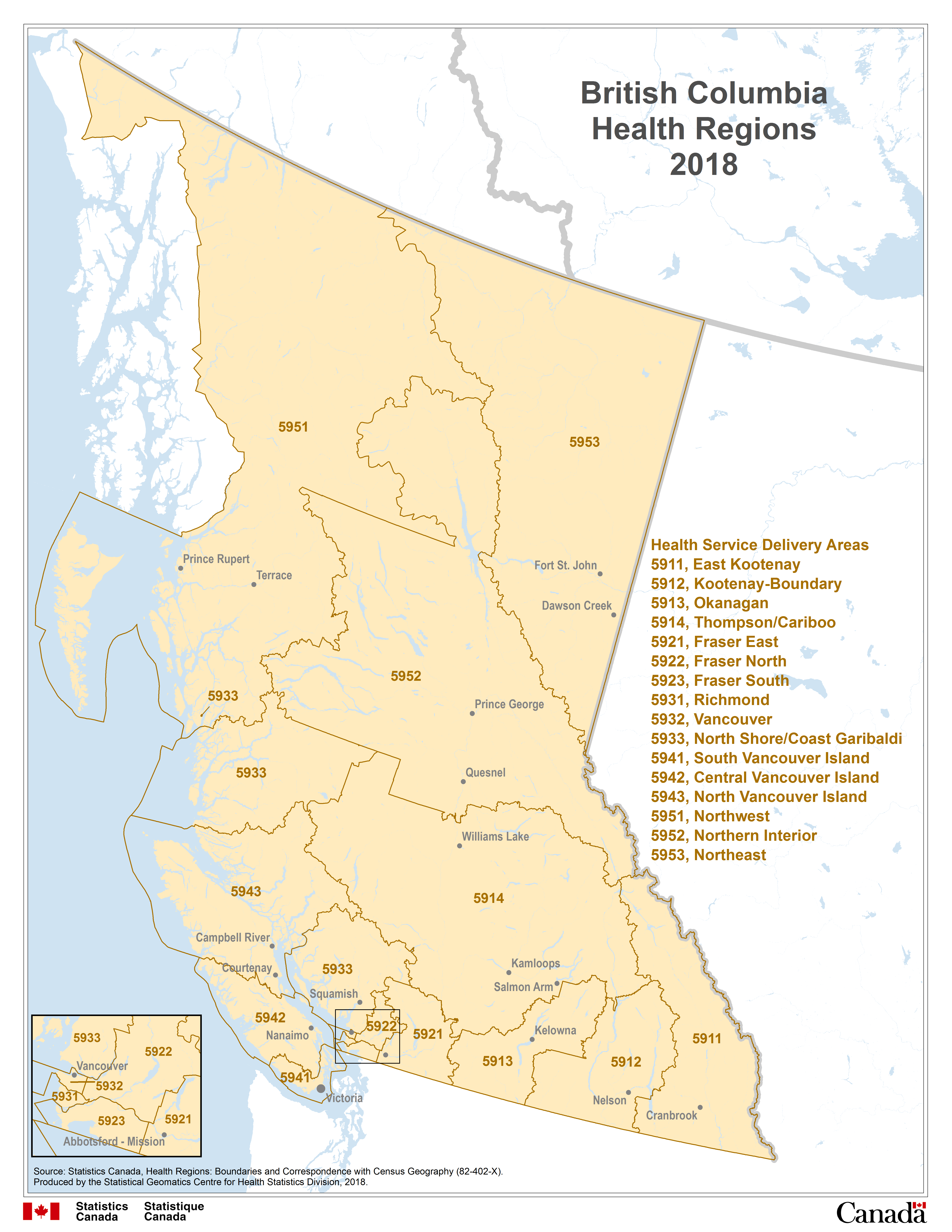
Description for Map 12
This map shows the sixteen Health Service Delivery Areas in British Columbia:
East Kootenay, code 5911, Kootenay-Boundary, code 5912, Okanagan, code 5913, Thompson/Cariboo, code 5914, Fraser East, code 5921, Fraser North, code 5922, Fraser South, code 5923, Richmond, code 5931, Vancouver, code 5932, North Shore/Coast Garibaldi, code 5933, South Vancouver Island, code 5941, Central Vancouver Island, code 5942, North Vancouver Island, code 5943, Northwest, code 5951, Northern Interior, code 5952, and Northeast, code 5953.
Health Service Delivery Areas are outlined by a thin black line and labeled in black text with their four digit health region code.
Water features are displayed on the map for reference purposes. Linear water features appear on the map as a thin blue line while water bodies are shaded blue. Some cities are labeled in black text, for reference purposes.
Source: Statistics Canada, Health Regions: Boundaries and Correspondence with Census Geography (82-402-X). Produced by the Statistical Geomatics Centre for Health Statistics Division, 2018.
- Date modified: