
Figure 1
Map showing the progression of the flooded area of the Red River in 2009 and comparison with the 1997 flood

Archived Content
Information identified as archived is provided for reference, research or recordkeeping purposes. It is not subject to the Government of Canada Web Standards and has not been altered or updated since it was archived. Please "contact us" to request a format other than those available.
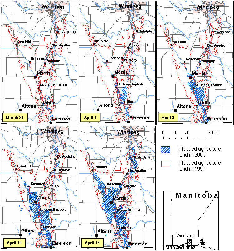
Figure source: Statistics Canada, 2009, "2009 Red River Valley Flood: Impact on Agriculture", catalogue number 18-504-X.
- Date modified: