
Chart 3.14
Land cover and land use, Lower Saskatchewan–Nelson drainage region, 2011
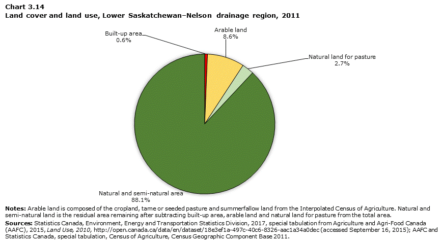
Data table for Chart 3.14
| Built-up area | Arable land | Natural land for pasture | Natural and semi-natural area | |
|---|---|---|---|---|
| square kilometres | ||||
| Lower Saskatchewan–Nelson | 2,290 | 30,894 | 9,901 | 317,802 |
|
Notes: Arable land is composed of the cropland, tame or seeded pasture and summerfallow land from the Interpolated Census of Agriculture. Natural and semi-natural land is the residual area remaining after subtracting built-up area, arable land and natural land for pasture from the total area. Sources: Statistics Canada, Environment, Energy and Transportation Statistics Division, 2017, special tabulation from Agriculture and Agri-Food Canada (AAFC), 2015, Land Use, 2010, (accessed September 16, 2015); AAFC and Statistics Canada, special tabulation, Census of Agriculture, Census Geographic Component Base 2011. |
||||
- Date modified: