Map 1
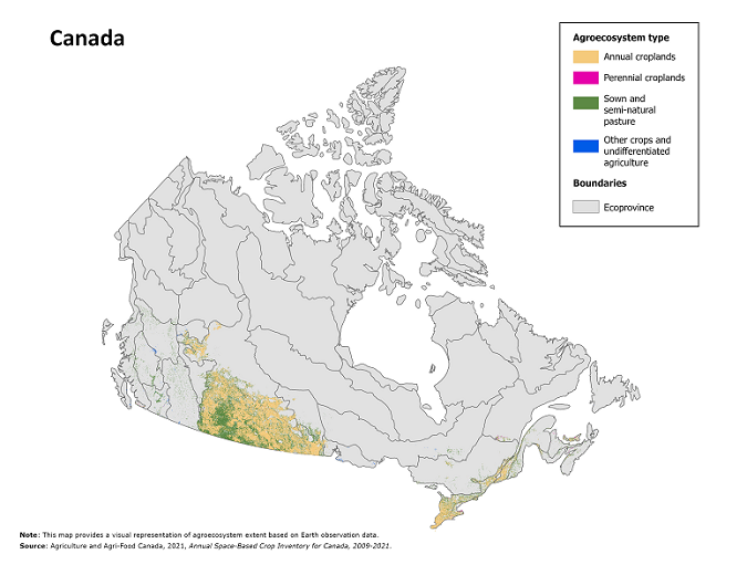
Canadian agroecosystem extent, by agroecosystem type, 2021, based on Earth observation data

Map description
The title of the map is "Canadian agroecosystem extent, by agroecosystem type, 2021, based on Earth observation data"
This map visually represents the distribution and extent of different agroecosystem types in Canada in 2021. The data used for this map were derived from a modified version of Agriculture and Agri-Food Canada's Annual Crop Inventory for 2021, reclassed into four agroecosystem types.
The map includes an overview of Canada, accompanied by a legend positioned on the top right side. Thin black lines delineate ecoprovinces.
The legend contains four categories: annual croplands (light orange), perennial croplands (dark pink), sown and semi-natural pasture (green) and other crops and undifferentiated agriculture (blue).
The map shows the most concentrated areas of agroecosystems are in the Prairie provinces and southern Ontario and Quebec.
Note(s): This map provides a visual representation of agroecosystem extent based on satellite Earth observation data.
Source(s): Agriculture and Agri-food Canada, 2021, Annual Space-Based Crop Inventory for Canada, 2009-2021.
- Date modified: