Map 3
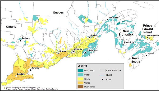
Crop and pasture growth conditions as of May 29, 2022, compared with the normal (as observed from 1987 to 2021), by census division, Central and Atlantic Canada

Map description
The title of the map is "Crop and pasture growth conditions as of May 29, 2022, compared with the normal (as observed from 1987 to 2021), by census division, Central and Atlantic Canada"
This map shows crop and pasture growth conditions as of May 29, 2022, compared with the average (as observed from 1987 to 2021), by census division, for Central Canada and the Atlantic provinces. Growth conditions were similar or worse than normal in the southern parts of Ontario, while similar to better than normal for Quebec and the Atlantic provinces.
Source(s): Crop Condition Assessment Program (5177), 2022.
- Date modified: