
Map 1
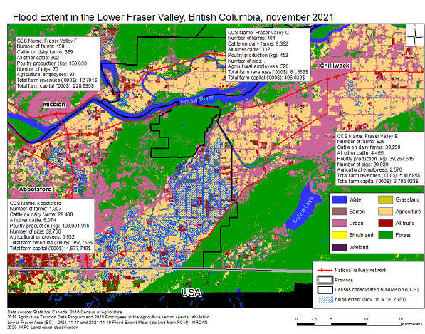
Flood Extent in the Lower Fraser Valley, British Columbia, November 2021
Map description
The title of the map is "Flood Extent in the Lower Fraser Valley, British Columbia, November 2021"
The map shows the geographic extent of the November 18 and 19, 2021 flood in the lower Fraser region in British Columbia, with the agricultural area affected.
Source(s): Statistics Canada, 2016 Census of Agriculture (3438), 2018 Agriculture Taxation Data Program (3447) and 2018 Employees in the Agriculture sector, special tabulation. Lower Fraser Area (British Columbia) - 2021-11-18 and 2021-11-19 Flood Extent Map (derived from regional county municipality) - Natural Resources Canada 2020 Agriculture and Agri-Food Canada Land cover classification.
- Date modified: