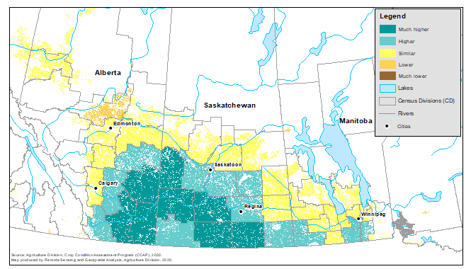
Map 3
Vegetation growth index as of the week of July 20, 2020 (during data collection), compared with normal, by census division, for Western Canada

Map description
The title of the map is "Vegetation growth index as of the week of July 20, 2020 (during data collection), compared with normal, by census division, for Western Canada"
The map shows Crop Condition Assessment Program data as of the week of July 20 to 26, comparing the Normalized Difference Vegetation Index in Western Canada with normal. Green colours indicate areas where crop conditions are higher than normal, yellow indicates where conditions are similar to normal, and brown indicates crop conditions lower than normal.
- Date modified: