Map 3
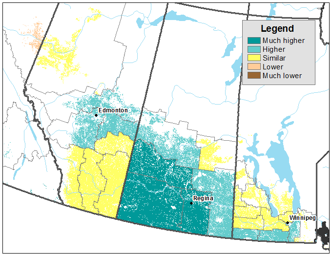
Vegetation growth index as of the week of July 15, 2019 (during survey collection), compared with vegetation index as of the week of July 1, 2019, by census agricultural region, for Western Canada

Map description
The title of the map is "Vegetation growth index as of the week of July 15, 2019 (during survey collection), compared with vegetation index as of the week of July 1, 2019, by census agricultural region, for Western Canada"
This map shows crop conditions in the week of July 15, 2019 compared with the week of July 1, 2019. Crop conditions were higher for central Alberta, most of Saskatchewan and southern Manitoba, and remained similar for southern Alberta and the northern part of Manitoba.
- Date modified: