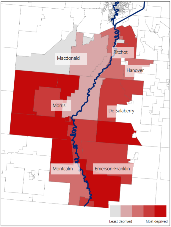
Map 4
Situational vulnerability in flood-affected dissemination areas in Southern Manitoba (Red River Valley)

Map description
The title of the map is "Situational vulnerability in flood-affected dissemination areas in Southern Manitoba (Red River Valley)"
The map shows areas impacted by flooding occurring in the Southern Manitoba region in spring 2019.
The legend shows a scale of deprivation for dissemination areas, shaded grey (least deprived) to dark red (most deprived).
On this map, water is shaded dark blue and the background is white (unaffected dissemination areas). Census consolidated subdivisions are labelled in black text composed of surrounding dissemination areas. The dissemination area boundaries are indicated as thin black lines and are coloured in grey (least deprived) to dark red (most deprived).
- Date modified: