Map 1
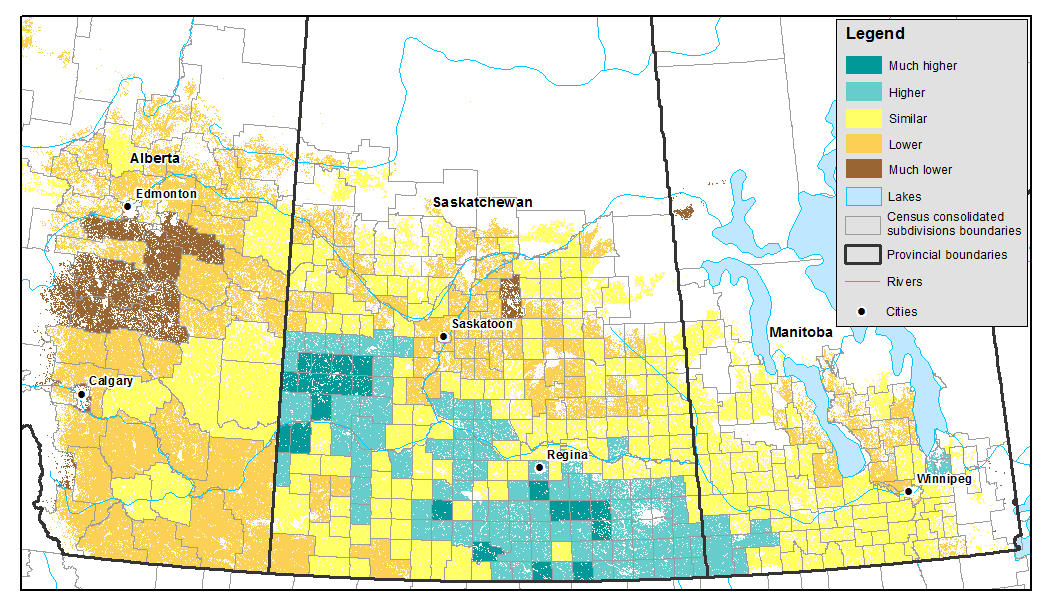
Vegetation growth index as of July 23 to 29, 2018 (during survey collection), compared with the last 30-year average, by census consolidated subdivisions

Map description
The title of the map is "Vegetation growth index as of July 23 to 29, 2018 (during survey collection), compared with the last 30-year average, by census consolidated subdivisions"
Vegetation growth index as of July 23 to 29, 2018 (during survey collection), as compared to last 30-year average, by Census Consolidated Subdivisions
This map shows conditions above normal for the southern part of Saskatchewan, below normal for most of Alberta and the northern part of Saskatchewan, and close to normal for Manitoba.
- Date modified: