 View the most recent version.
Information identified as archived is provided for reference, research or recordkeeping purposes. It is not subject to the Government of Canada Web Standards and has not been altered or updated since it was archived. Please "contact us" to request a format other than those available.

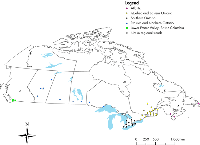
Notes: Regional clusters were defined by Environment Canada. Numbers of stations per region are: Atlantic (3);
Quebec and Eastern Ontario (25); Southern Ontario (21); Prairies and Northern Ontario (14); Lower Fraser
Valley, British Columbia (11); Not in regional trends (5).
Sources: Environment Canada, National Air Pollution Surveillance Network Database; Statistics Canada, Environment
Accounts and Statistics Division.
Map source: Government of Canada. 2005. Canadian Environmental Sustainability Indicators. Statistics Canada. Catalogue number 16-251-XIE2005000.